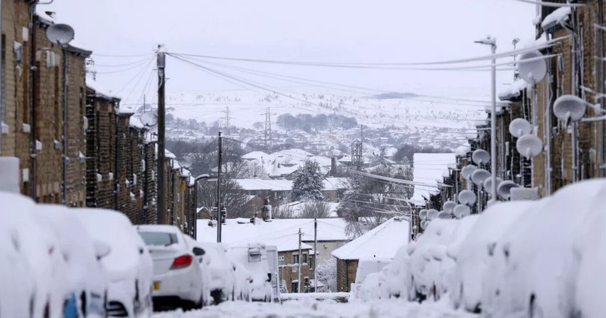
The UK could see snow over the festive period as the Met Office released it’s early predictions for Christmas weather – with “a risk of some snow” on the cards.
An unseasonable cold spell has ravaged the UK over the last week, with wintry sub-zero lows, wind, rain and even coverings of snow preceding much more extreme conditions as Storm Bert made landfall this weekend. Weather warnings from the Met Office, while now confined to Scotland, are set to last into Monday as Bert’s grip loosens, with the agency signalling a more settled outlook ahead.
And as winter officially arrives, there are early murmurs of snow being on the cards this Christmas, with the Met Office predicting snowy condition could “dominate towards the middle of December”.
The Met Office said of the period between December 9 to December 23: The start of this period looks like being largely settled, with high pressure close to if not over the UK. However as we move further into December there are signs that it will become less settled with west or northwesterly types preferred.
“These will bring some wetter and windier interludes with a risk of some snow, especially for hills in the north. These conditions look more likely to dominate towards the middle of December. Temperatures generally close to average through the period.”
Meanwhile, some people have more urgent weather concerns on their mind before the temperatures turn in December, as some Met Office warnings are still in place for windy and rainy conditions caused by Storm Bert. The last remaining yellow alert for wind is in place for the Scottish west coast, and will last until 10am today.
The Met Office alert states that Bert’s remnants will whip up near-gale-force 70mph gusts that could prove troublesome for people living in and travelling through exposed areas. The agency warns: “As Storm Bert moves east across the north of Scotland, a further spell of very strong winds will move east to affect parts of western, central and northern Scotland.
“Gusts of 50 to 60mph are likely and as much as 70 mph near western coasts and on exposed bridges.” People living in the alert area have been warned to expect delays to most types of public transport, with coastal routes to be most effected, and “short term loss of power” also on the cards.
The Met’s long range forecast covers the period from December 4 to December 18 and predicts a cold lead up to Christmas. It reads: “The start of this period looks like being largely settled, with high pressure close to if not over the UK. However, there is also a chance of more changeable weather patterns, which would see Atlantic weather systems periodically move across the country.
“These will bring some wetter and windier interludes with a risk of some snow, especially for hills in the north. These conditions look more likely to dominate towards the middle of December. Temperatures generally close to average through the period.”
It adds that conditions may feel chilly, particularly during clear nights, but there is no indication yet of widespread or severe cold snaps. The Met Office’s outlook suggests that residents across the UK should prepare for a mix of calm and unsettled weather. Those in northern regions, particularly higher-altitude areas, should be mindful of the potential for snow and challenging travel conditions.
Wendy’s Reacts to Backlash Over Joke About Leaving Katy Perry in Space: ‘Always Bring a Little Spice’
Michael Bublé Is Living The Good Life With His Family In A Multi-Million Dollar Mansion In His Hometown.
Dolly Parton’s best duet yet: ‘There Was Jesus’
Grooving Groom Daniel Lewis’s Epic Dance Entrance With His Boys Makes Wedding Goes Viral.


